State lawmakers aim to fix decades-long neglect of land survey monuments
— Updated 12:35 p.m.
Public land survey monuments are the basis of all property descriptions and infrastructure siting in the state along with serving as a basis for accurate digital geospatial data.
However, only about 148,000 of the original 325,000-plus markers have a known location.
“The public land survey system predates the state of Minnesota. There’s been 150 years of neglect which has taken its toll and flaws are becoming worse. When you don’t have an accurate system of surveys and survey corners it leads to lawsuits among private property owners and there’s lots of uncertainty where property boundaries lie,” said Rep. Mike Freiberg (DFL-Golden Valley).
Counties have the authority to determine where monuments are located. It costs approximately $1,800 to find each one.
Freiberg sponsors HF1478 that would build off a program established two years ago to help with those costs by appropriating $10 million in fiscal year 2026, making that the base for fiscal years 2027 and 2028, adding tribal governments as qualified applicants and amending prioritization criteria for applicants.
In May 2024, 34 counties were awarded a combined $9.1 million.
As amended, the bipartisan bill was held over Thursday by the House State Government Finance and Policy Committee for possible omnibus bill inclusion.
“This is an underappreciated bill, but also extremely important,” said Rep. Kristin Bahner (DFL-Maple Grove).
[MORE: Original public land survey plats of Minnesota]
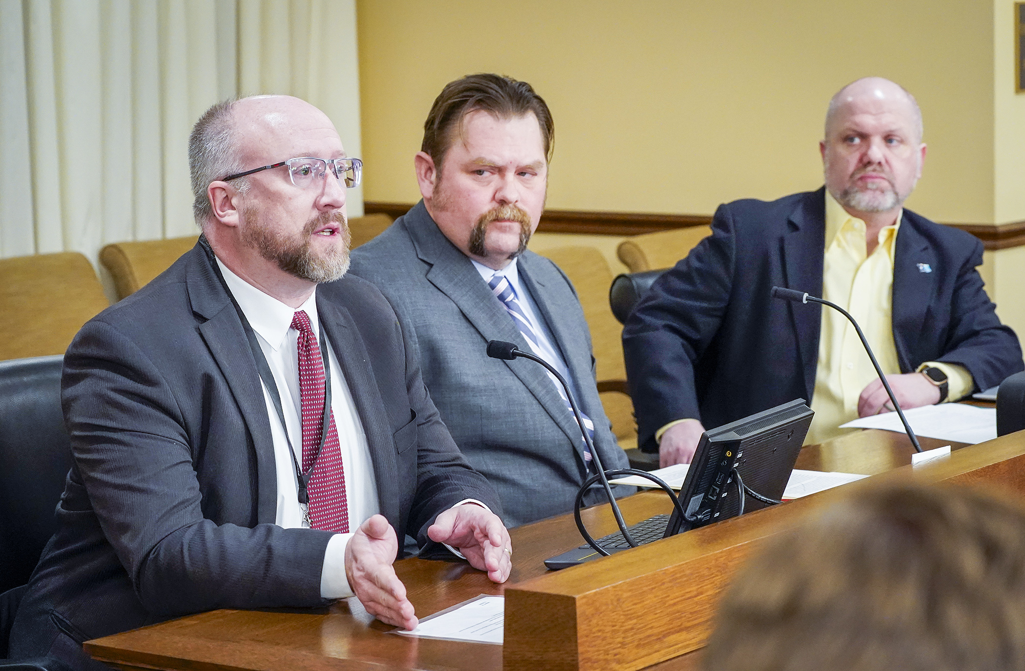
Preston Dowell, deputy county surveyor for St. Louis County, spoke of the bill’s benefits.
“It enables us to secure property transfers, reduce the time and costs on development projects, road projects, all kinds of different work that’s going on out there. Property disputes arise due to a lack of PLSS monumentation which leads to expensive lawsuits, title resolution cases, surveys, and all kinds of things. … Better location of these monuments will enable us to update our maps with more accurate data, improve land management and ensure that our taxation systems are accurate.”
Rep. Thomas Sexton (R-Waseca) has some experience in pipeline surveying.
“The more monuments we have will make things not only more accurate, but much cheaper for the landowner when they need to get it surveyed.”
Related Articles
Search Session Daily
Advanced Search OptionsPriority Dailies
Speaker Emerita Melissa Hortman, husband killed in attack
By HPIS Staff House Speaker Emerita Melissa Hortman (DFL-Brooklyn Park) and her husband, Mark, were fatally shot in their home early Saturday morning.
Gov. Tim Walz announced the news dur...
House Speaker Emerita Melissa Hortman (DFL-Brooklyn Park) and her husband, Mark, were fatally shot in their home early Saturday morning.
Gov. Tim Walz announced the news dur...
Lawmakers deliver budget bills to governor's desk in one-day special session
By Mike Cook About that talk of needing all 21 hours left in a legislative day to complete a special session?
House members were more than up to the challenge Monday. Beginning at 10 a.m...
About that talk of needing all 21 hours left in a legislative day to complete a special session?
House members were more than up to the challenge Monday. Beginning at 10 a.m...